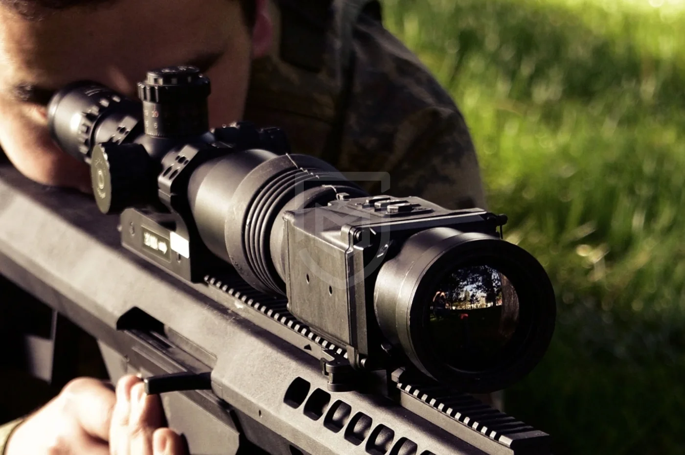
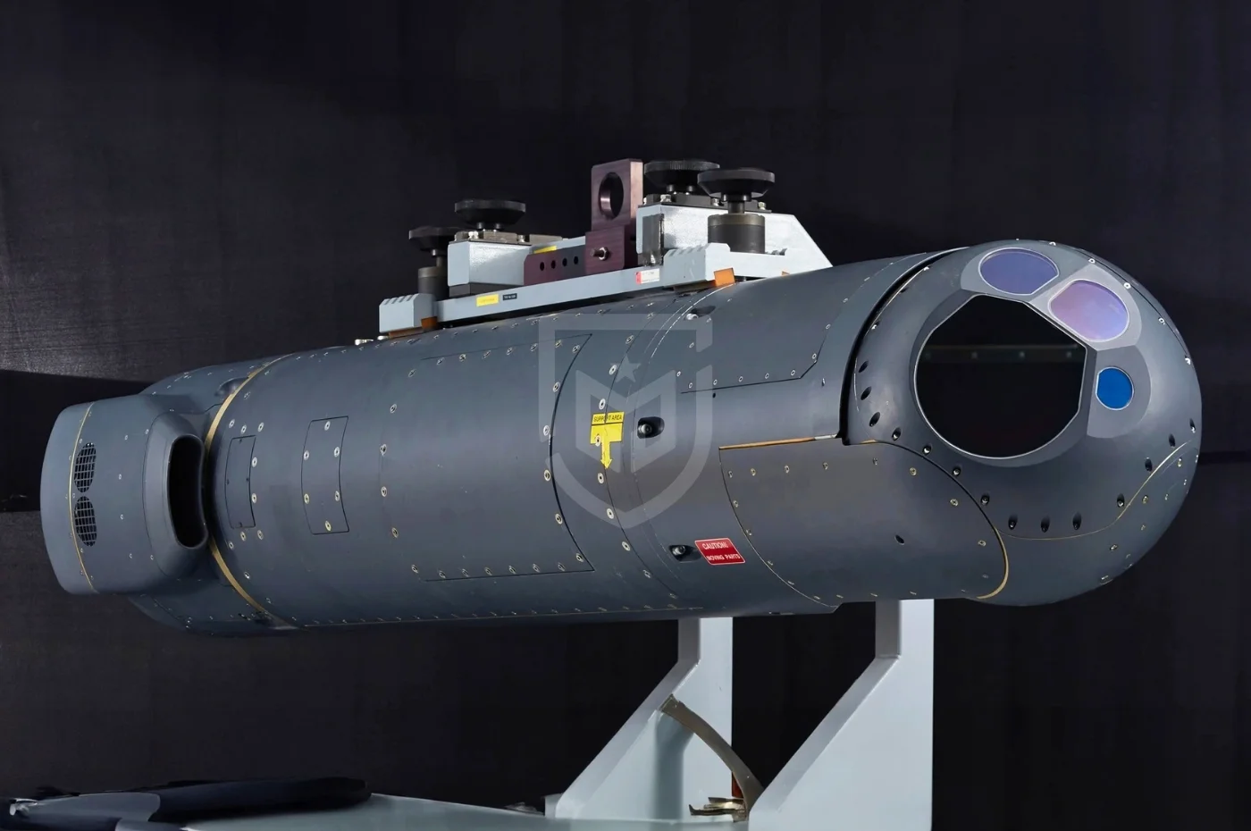
CATS is designed to enable UAV platforms not only to conduct intelligence, surveillance, and reconnaissance (ISR) missions but also to perform precision strike operations. It serves as the primary sensor node within the UAV’s targeting chain, providing real-time imagery, target identification, coordinate generation, and laser designation.
Operational Purpose and Role
CATS fulfills multiple mission roles:
- Intelligence, Surveillance and Reconnaissance (ISR)
- Target detection and identification
- Precision coordinate generation
- Laser designation for guided munitions
- Border security and counter-terror operations
It is particularly optimized for MALE-class UAVs operating at medium to high altitudes.
Doctrine and Concept of Operations
Within modern air warfare doctrine, UAVs act as forward sensor nodes in the kill chain. CATS functions as a critical ISR and targeting subsystem:
- Target detection via IR/TV/NIR sensors
- Target confirmation and classification
- Laser range measurement
- Precise geo-location
- Laser designation for guided weapons
This architecture enables a closed-loop fire control mechanism, especially when integrated with laser-guided munitions.
System Architecture
CATS is built around a multispectral sensor fusion concept:
- 220 mm Common Aperture Optics: All sensors share the same optical axis, minimizing parallax error and enhancing targeting precision.
- MWIR Thermal Camera (3–5 µm): Effective for long-range detection in night and degraded visibility conditions.
- Full HD Day TV Camera (1920×1080): High-resolution daytime imaging.
- DI-NIR Camera: Enhanced low-light imaging performance.
- Laser Target Designator and Rangefinder (1064 nm): Compatible with STANAG 3733 Band I & II.
The system interfaces with mission computers via RS-422, MIL-STD-1553B, HD-SDI, and PAL video outputs.
Stabilization and Precision
CATS incorporates a high-precision Inertial Measurement Unit (IMU) and advanced gyroscopic stabilization, enabling:
- Stable imaging at high altitudes
- Operation under turbulence
- Accurate narrow field-of-view targeting
- Reliable coordinate generation
Survivability and Environmental Tolerance
- Operating temperature: -54°C to +52°C
- Storage temperature: -55°C to +70°C
- 360° continuous azimuth rotation
- +57° / -105° elevation range
- Line Replaceable Unit (LRU) architecture
These characteristics enhance operational availability and reduce maintenance downtime.
Adaptation to Modern Threat Environment
Advantages:
- Long-range laser designation (up to 35 km, publicly available data)
- Multi-target tracking capability
- Real-time motion analysis
- High-resolution identification performance
Limitations:
- Performance degradation in dense fog, heavy precipitation, or sandstorms (typical for EO systems)
- Unlike radar, it does not provide wide-area search capability
Platform Integration and Ecosystem
According to publicly available information, CATS has been integrated on platforms produced by:
- Baykar (Bayraktar TB2)
- Turkish Aerospace Industries (ANKA UAV family)
Different software configurations and system blocks allow adaptation to multiple UAV platforms.
Detailed Technical Specifications
Dimensions and Weight
- Common aperture diameter: 220 mm
- Width: 427 mm
- Height: 519.5 mm
- Weight: ~55 kg
Power Supply
Performance
- Laser rangefinder range: up to 35 km (publicly available data)
- 360° continuous rotation
- High-precision stabilization
Sensors
- MWIR IR Camera: 640×512 resolution, 3–5 µm
- HD Day TV: 1920×1080 resolution
- DI-NIR: 800×600 resolution
Laser Systems
- Wavelength: 1064 nm
- STANAG 3733 Band I & II compliant
- NIR laser pointer and illuminator compatible with night vision devices
Data Interfaces
- RS-422
- MIL-STD-1553B
- SMPTE-292M HD-SDI
- PAL
Environmental Endurance
- Operating: -54°C / +52°C
- Storage: -55°C / +70°C
Frequently Asked Questions
What is CATS used for?
- CATS is used for reconnaissance, surveillance, target identification, coordinate generation, and laser designation for precision-guided munitions on UAV platforms.
What is its maximum range?
- The publicly stated maximum laser rangefinder capability is up to 35 km. Detection and identification ranges depend on target size, atmospheric conditions, and operational altitude.
Is it a radar system?
- No. CATS is an electro-optical system. It operates passively using optical and infrared sensors.
How many targets can it track simultaneously?
- It has multi-target tracking capability; however, the exact numerical tracking capacity is not publicly disclosed.
Is it fixed or mobile?
- It is an airborne stabilized turret integrated into UAV platforms.
What are its foreign equivalents?
- Comparable systems include the L3Harris WESCAM MX series and FLIR Star SAFIRE systems. CATS differentiates itself through its indigenous development and common aperture optical architecture.
Sources
- ASELSAN official product documentation
- ASELSAN public technical brochures
- International defense exhibition materials
- Open-source defense industry publications