


Air Forces News
Electronic Systems


BREAKING NEWS

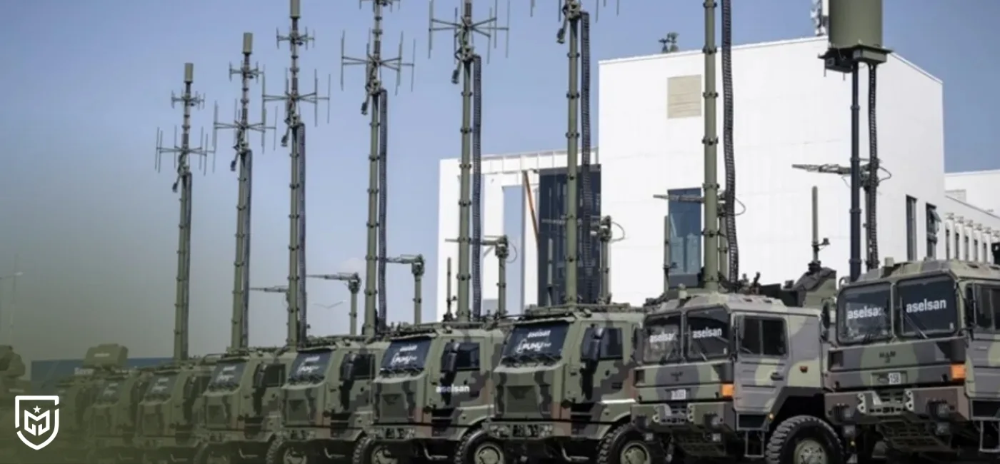
Türkiye’s defense industry has developed a specialized satellite communication solution for unmanned aerial vehicles (UAVs) operating in the challenging conditions of the Equatorial Region. Satellite communication is vital for long-range UAV missions, providing secure, uninterrupted data, video and command transmission regardless of geographical obstacles. However, geosynchronous satellites positioned directly above the Equator force ground and airborne terminals in the region to point at extremely steep angles, creating a technical difficulty known as the “Keyhole Effect.” This phenomenon often leads to signal loss and unstable tracking due to the extremely narrow field of view.
To address this issue, Türkiye’s CTech engineered the SkyARX Ku 20 Qx antenna system, designed specifically for high-elevation satellite tracking. The system features a four-axis stabilization mechanism—azimuth, elevation, polarization and cross-elevation—which allows the antenna to maintain precise alignment with the satellite even as the aircraft maneuvers. This ensures continuous communication, even when the satellite appears almost at the zenith point in the sky.
CTech General Manager Cüneyd Fırat emphasized that the system was engineered with the unique dynamics of the Equatorial Region in mind. He noted that the SkyARX Ku 20 Qx effectively mitigates the Keyhole Effect, enabling reliable, uninterrupted operation in high-angle scenarios. According to Fırat, the system provides robust communication for both civilian and military UAV missions, supporting secure data transfer and high-resolution video transmission under demanding conditions.
Thanks to this advanced technology, Türkiye’s national UAVs can perform missions in the Equatorial Region without communication interruptions, offering a significant operational advantage. The SkyARX Ku 20 Qx not only demonstrates the engineering capabilities of Türkiye’s defense sector but also stands out as a strong solution for countries requiring stable satellite connectivity in difficult geographical environments. Its precision, durability and high-angle tracking capacity elevate satellite communication infrastructure to a new standard.

The cookies used on our website are used to provide you with a better user experience and to improve our website. You can manage your cookie preferences from the options below.
 Rabia Kılıç
Post Comment
Comments
No comments yet.
Related News
France develops multi-layered air defense system for SAMP/T NG
ÖZGÜR Project: National Mission Planning Software Integration for F-16s
Airbus U145 fully autonomous unmanned helicopter unveiled
New Generation Fighter Jet Project Led by Airbus Coalition
Turkish defense sector targets top 10 global exporters by 2028
Roketsan's Alka Laser System: Core Layer of Türkiye's Air Defense Architecture
Cyprus Procures Tamnava MLRS from Serbia, H145M Helicopters from France
ROKETSAN ALKA Strengthens STEEL DOME Laser Air Defense Capability